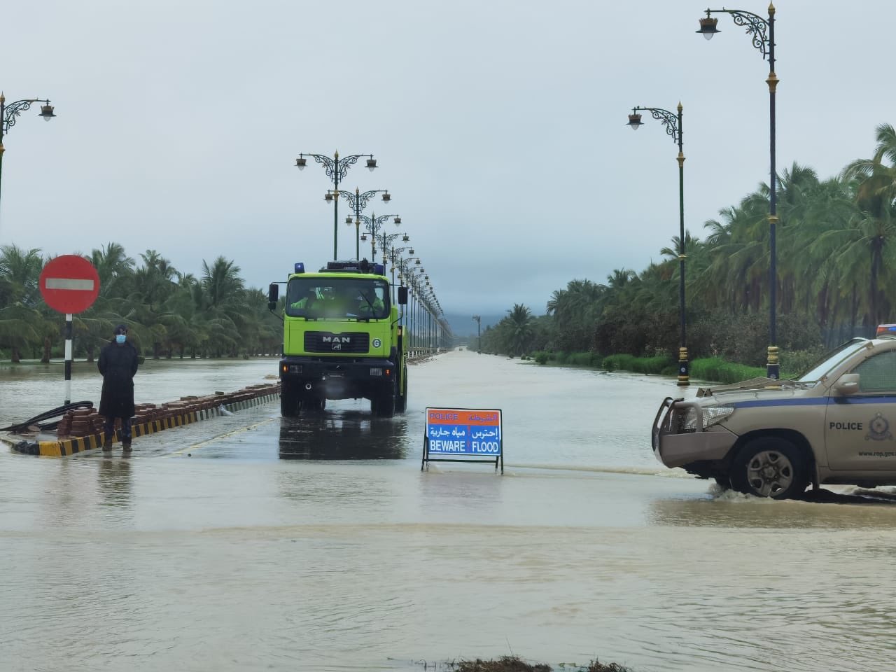

Incessant rain caused by a low depression formed over the Arabian Sea on Friday, has caused flash floods in many parts of Salalah and all the low lying areas have been submerged in water. Most of the wadis (natural canals) are overflowing causing roadblocks in many areas.
Water has entered the basement of many houses, as people were seen moving household items and vehicles to safer places. The average accumulation of water in low lying areas is knee-deep to waist-deep.
Salalah and its adjoining areas saw heavy rains, even as the latest weather charts and the analysis of the National Multi Hazards Early Warning Center indicated that the Tropical depression is located south of coastal areas of Dhofar governorate at longitude 54.5°E and latitude 16.5°N with estimated surface wind speed around the center between 17 and 25 knots (30 to 45 Km/hr).
The continuous of heavy rain (100-200 mm) during the next 24 hours associated with fresh to strong winds and wadis with a reduction in horizontal visibility and sea conditions will be rough along with governorates of Dhofar (4-5 meters) and Al Wusta (3 meters).
“People got up to morning thunderstorms and lightning on Friday. My house is located in a relatively low-lying area and by the time I got up, I saw water entering into my car. Quickly I shifted it to a higher plane,” said Salalah resident Faisal.
“In fact, I called many other neighbors to move their cars as they were apparently getting submerged in water,” he said.
The Sultan’s Armed Forces (SAF) has confirmed its readiness to deal with the tropical situation in the Arabian Sea and Dhofar Governorate’s Emergency Cases Management Committee has discussed the readiness of all sectors to deal with the tropical condition in the governorate.
Due to the heavy rains and accompanying strong winds, the PACA has advised people to take precautions and avoid low lying areas.
The eastern parts of Dhofar like Hasik, Shoyemiya, Halaniyat and Sadah, Mirbat, and Taqah received heavy rains. In all likelihood, the rain and thunderstorm would continue till Sunday.
“Due to the continuous flow of rain clouds in Dhofar Governorate, heavy rains leading to flowing wadis have been reported from the Dhofar governorate,” Oman Meteorology said,
People have been urged to be careful and avoid crossing valleys. The Public Authority Civil Defence and Ambulances (PACDA) is mobilising its force in Dhofar to deal with the tropical depression in the governorate.
According to National Multi Hazards Early Warning Center, the amount of rain expected is 50-90mm associated with a fresh wind, flash floods with reduced horizontal visibility, and rough conditions with a wave height of 2-4 meters in the next 24 hours.
The weather map indicates the continuous flow of clouds accompanying the depression with heavy thundershowers.
Mirbat recorded the highest amount of rainfall since the low depression formed over the Arabian Sea and began its impact on Dhofar Governorate on Wednesday. Mirbat was followed by Qairoon Hairiti, Taqah, Salalah and Sadah.
Thunderstorm advisory had been alerted for Taqah, Mirbat, Salalah Port, Shaleem, Halaniyat Islands, Qairoon Hairiti, and Sadah.
The system has been developing over the southwest Arabian Sea near Socotra Island.
The Ministry of Agriculture and Fisheries urged farmers to be cautious during the weather system. The Ministry called on all farmers, breeders of livestock, and beekeepers to take the necessary precautions to ensure their safety as well as their livestock and hives, not to risk grazing livestock and keep them away from wadis and not to leave hives in low lying areas.
The impact of the tropical weather, which began on Wednesday night, is expected to last until Sunday as per the current indication on the intensity of the system. Along coastal areas of Oman Sea wind will be northeasterly light to moderate during the day becoming variable light at night and over the rest of the Sultanate winds will be southerly to southeasterly light to moderate occasionally fresh along Arabian Sea coasts.
Oman Observer is now on the WhatsApp channel. Click here


