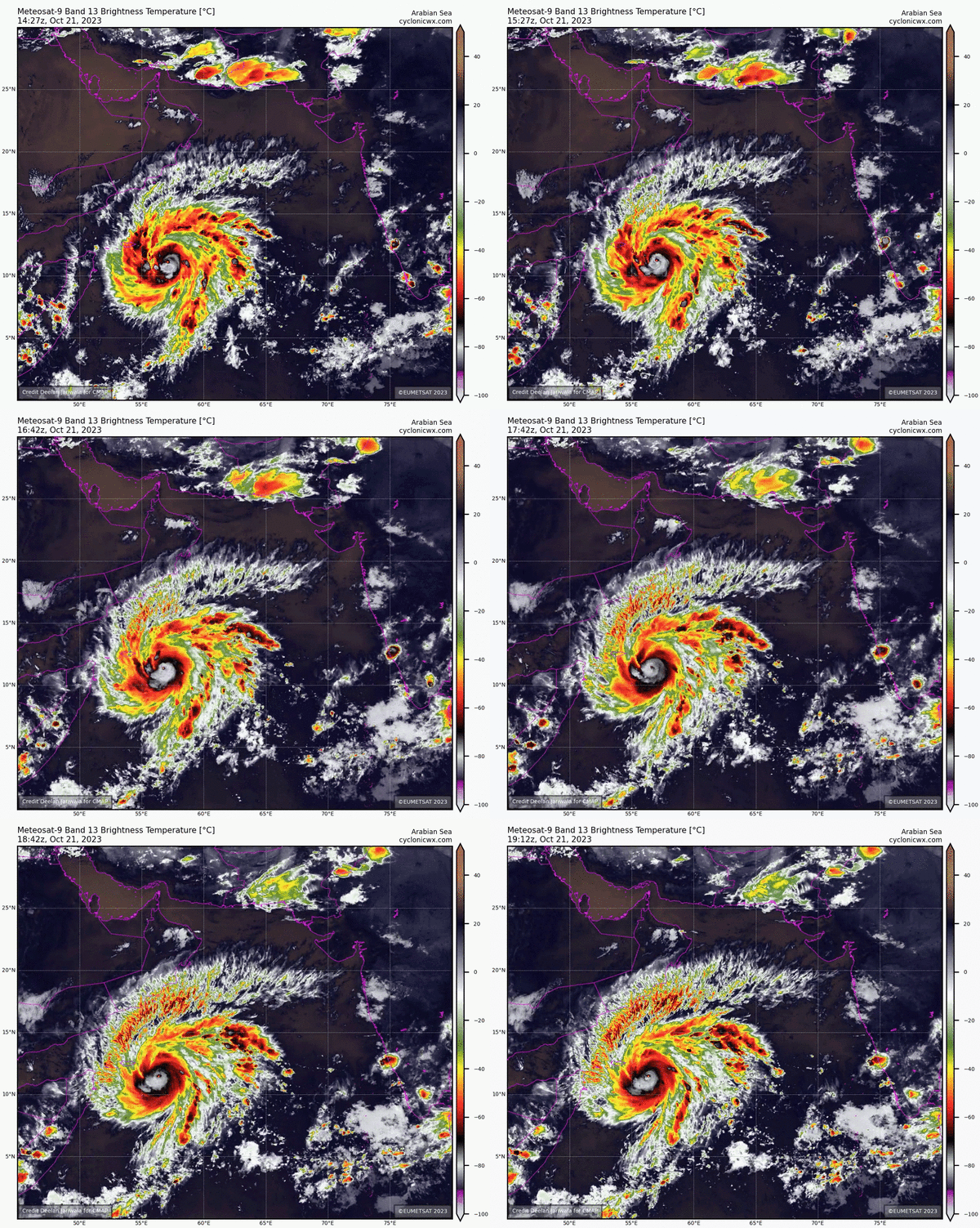

Salalah: National Committee for Emergency Management on Sunday said the agency have activated shelters across Dhofar in light of the approaching cyclone Tej.
The direct impact is expected to begin in Dhofar and Al Wusta governorates starting from Sunday with heavy rainfall (50 — 150) mm with inundated water due to storm surge.


The latest satellite images at the National Multi Hazards & Early Warning Center indicate the intensification of the tropical cyclone (Tej) to a category (3) cyclone.
It lay centered on Latitude 12.3 °N and Longitude 55.3 °E and is around 500 km from the nearest coast of Oman.
Wind speed around the center is estimated to be between 100 to 112 Knots, and the nearest rainy cloud mass is estimated to be 280 km away from the coasts (Wilayat of Sadah).
The forecasts suggest that the system will continue to move west-northwest towards the coasts of Dhofar governorate and the Republic of Yemen (Al Mahra) and is likely to further intensify into a Category (4) cyclone within the upcoming 24 hours.
Oman Observer is now on the WhatsApp channel. Click here


